

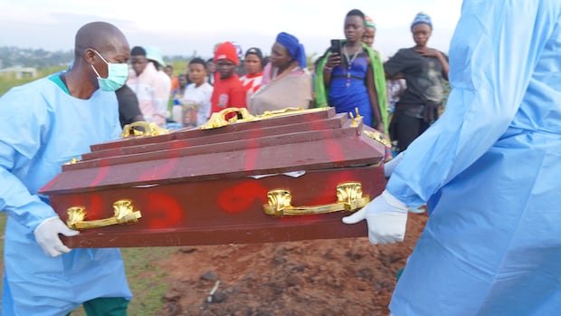
Health officials in eastern Democratic Republic of Congo are utilizing anonymized mobile-phone data to track population movements and predict potential areas where the Ebola virus could spread next. This innovative approach, a first in Ebola response efforts, is being implemented as authorities grapple with the fastest-growing Ebola outbreak on record, with over 6,250 cases and 3,039 fatalities since the outbreak’s inception on May 15, according to government data.
The current outbreak, the 17th in Congo, is caused by the Bundibugyo strain of Ebola, for which there are no approved vaccines or treatments available. Given the escalating spread of the virus, health officials are keen on identifying potential outbreak hotspots to effectively allocate limited surveillance and response resources.
Olivier Le Polain, the head of epidemiology and analytics for response at the WHO Health Emergencies Programme, emphasized the significance of understanding population movements in outbreak scenarios, especially in the current epidemic. Traditional risk assessments typically focus on immediate outbreak areas, assuming that the virus will likely spread to nearby regions. However, analyzing mobility data enables responders to pinpoint risks in areas that may be physically distant but interconnected through travel patterns.
Flowminder, a Swedish non-profit organization, is responsible for producing the analysis using anonymized mobile phone records. These records are generated when mobile phone users connect to telecom networks, providing insights into their movements across the country. Vodacom, the largest telecom operator in Congo, supplies the data free of charge for this purpose.
The data is aggregated and anonymized to safeguard individual privacy, ensuring that no personal subscriber information is accessible. Linus Bengtsson, the founder of Flowminder, highlighted the importance of understanding how people move to predict the movement of infectious individuals accurately.
Flowminder’s initial analysis, published in early June, focused on areas where the outbreak originated, such as Bunia, Mongbwalu, and Rwampara. By tracking travel patterns in these regions, researchers identified that all 10 destinations receiving the largest flows of travelers from the initial outbreak areas had reported confirmed Ebola cases by the end of June.
As the outbreak expanded, Flowminder extended the analysis to other affected regions, particularly focusing on areas where departing individuals from hotspots were likely to travel. Notably, Kisangani, a significant transport hub on the Congo River, emerged as a high-risk location for potential virus spread, prompting intensified operations before any confirmed cases were detected.
Recent studies have underscored connections between Kisangani and other regions like Kinshasa, raising concerns about potential spread to Congo’s capital and other neighboring countries. The WHO continues to emphasize the risk of the outbreak reaching Kinshasa, with a modeling exercise projecting a 70% probability of a case being detected there by the end of September.
Despite its valuable insights, the analysis is constrained by its reliance on data from Congolese mobile networks, offering only a partial view of international movements. Efforts are underway to collaborate with other telecom operators to enhance coverage and obtain more comprehensive data for a more detailed understanding of population movements in response efforts.