

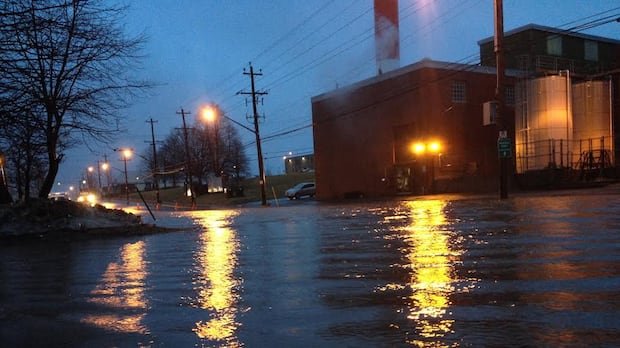
A slow-moving weather system is causing substantial rainfall in northeastern Nova Scotia, specifically impacting Cape Breton over the weekend. Environment and Climate Change Canada has issued orange and yellow alert level rainfall warnings for these areas. Intense downpours and thunderstorms are resulting in rainfall rates of 10 to 20+ millimetres per hour, leading to potential localized flooding and dangerous travel conditions.
Late Saturday morning, more than 21,000 Nova Scotia Power customers experienced power outages, with a majority of the outages concentrated in Cape Breton. The system has already brought heavy rainfall to the island, with widespread precipitation amounts ranging from 100 to 200 millimetres recorded by Saturday morning. Some private weather stations in Richmond County have reported exceeding 200 millimetres, causing washouts and localized flooding. Eskasoni received 20-30 millimetres per hour overnight and was nearing the 200-millimetre mark by mid-Saturday morning. Rainfall is expected to persist, with an additional 15-to-30 millimetres throughout the day, and the possibility of up to 50 millimetres locally, particularly in Victoria County and along the Cape Breton County coastline.
The rainfall will continue into Saturday night, with an additional five-to-15 millimetres forecasted, and higher local amounts still a possibility, especially in Victoria County and coastal Cape Breton County. The system is also generating winds gusting at 60-80 km/h across the island, resulting in power outages. By Sunday, both the rain and wind are expected to diminish, though lighter rain and showers will persist, accompanied by winds gusting at 50-60 km/h.
Northeastern regions such as Guysborough, Antigonish, Pictou, as well as northern Colchester and Cumberland counties, have also experienced significant rainfall. Rainfall totals of 40 to 70 millimetres have been widespread, with localized amounts nearing 100 millimetres in certain areas by mid-Saturday morning. Periods of heavy rain and thunderstorms are expected to persist in the east throughout the day, with an additional 10-to-20 millimetres forecasted, potentially higher near the Northumberland Strait. The rainy conditions will continue through the night and into Sunday, with total accumulations reaching 70 to 150 millimetres by the end of Sunday.
In central regions, rain showers will continue on Saturday and Saturday night, with lingering showers expected on Sunday. Additional rainfall of 5-10 millimetres is anticipated for most of the central region by Sunday evening, although higher amounts are more likely for northern Colchester and Cumberland counties. Temperatures in central areas are expected to remain in the mid-teens for both Saturday and Sunday, with northerly winds gusting at 50 to 60 km/h.
Further west, areas like the western Annapolis Valley, South Shore, and Tri-County regions will see lingering showers over the weekend, with the possibility of sunny breaks, especially in Annapolis, Digby, Yarmouth, Shelburne, and Queens counties. These areas will experience milder conditions, with highs ranging from the mid-to-upper teens for Saturday and Sunday. Winds gusting at 40–50 km/h will maintain a fall-like feel in the air during these days. Monday is expected to bring lighter winds, ample sunshine, and temperatures rising into the upper teens and low 20s.
Overall, the weather patterns across Nova Scotia are anticipated to gradually improve as the weekend progresses, with a mix of sun and cloud expected on Monday, along with a chance of lingering showers and slightly warmer temperatures.