

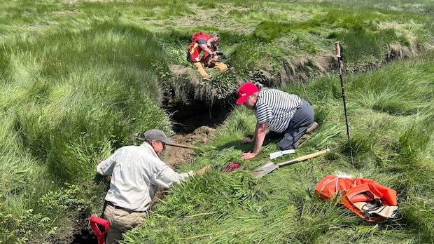
On a waterway in southwest Nova Scotia, an inquiry by a historical detective is revealing long-forgotten remnants of North America’s history.
Allains River, previously known as Lequille River, is a meandering tributary of the Annapolis River, stretching from the province’s interior to what is now Annapolis Royal. Around four centuries ago, the river hosted one of the earliest industrial facilities established post-colonization: a flour mill constructed in 1607 and later destroyed by fire in 1643.
The precise location of this mill remained a mystery for generations. However, now, an amateur historian from the United States, alongside a group of researchers and archaeologists, is inching closer to identifying its whereabouts, thereby illuminating the narrative of colonization, encounters, and the enduring presence of the Mi’kmaw people in Nova Scotia.
Mark Borton, a writer from Connecticut spearheading the search for the Poutrincourt gristmill, expressed the significance of unraveling this captivating enigma. He emphasized the pivotal role this site played in history, remarking, “An astonishing number of things transpired at this very spot.”
In 1605, a fortified fur-trading post was erected at what Samuel de Champlain dubbed Port Royal, situated on the Annapolis Basin. The settlers necessitated a mill for flour production, as bread accounted for a quarter of the French dietary intake during that era. The Poutrincourt gristmill, a water-driven grain-grinding mill, is depicted on maps from that period, including Champlain’s own portrayal.
Borton’s interest was piqued by Champlain’s map, which he stumbled upon during his exploration of the Maritimes in 2018. Recognizing the mill’s historical significance, Borton embarked on a mission to locate it, considering it the oldest mill in North America and a pioneering moment in industrial power on the continent.
Despite the challenges posed by inaccuracies in contemporaneous maps, Borton ventured beyond conventional theories and identified a potential site situated away from the speculated locations. By overlaying elements from Champlain’s map onto current geographical features, Borton narrowed down a probable location, spotting a faint square at the marsh’s edge on Google Maps, potentially representing a foundation.
Borton secured a permit from the Nova Scotia Museum to proceed with his investigations, aiming to confirm the mill’s existence. Utilizing Champlain’s map as a guide, Borton also identified a Mi’kmaw fishing weir opposite the mill site, further corroborating the historical context. Through advanced mapping techniques and collaboration with research institutions, Borton uncovered traces of dikes dating back to the early 17th century, providing tangible evidence to support his theories.
The project has attracted the involvement of archeologists from Kwilmu’kw Maw‑klusuaqn and Saint Mary’s University, aligning with ongoing research on the French-Mi’kmaq interactions during that era. Jonathan Fowler, an anthropology professor at Saint Mary’s, highlighted the significance of the Allains River in showcasing a shared landscape, intertwining European and Indigenous histories.
Fowler’s team plans to employ ground-penetrating radar to delve deeper into the mill site, aiming to unveil more insights into this pivotal historical era. The collaborative effort to unearth historical sites on Allains River serves as a testament to shared heritage and cooperation, potentially offering valuable lessons for the present and the future.