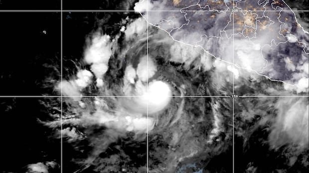
Hurricane Simon was on a trajectory toward a portion of Mexico’s Pacific coastline on Friday and was projected to significantly strengthen. U.S. meteorologists issued a hurricane warning for regions along the central and southwest coast, anticipating hurricane-level winds within 36 hours. As of early Friday, Simon boasted maximum sustained winds of 120 km/h and was advancing northwest at a rate of seven km/h, according to the U.S. National Hurricane Center in Miami.
The Category 1 hurricane was expected to veer northward by early Saturday and draw close to the coastline. Simon was forecasted to rapidly intensify, potentially escalating to a Category 4 storm before making landfall. Category 4 hurricanes, as per the Saffir-Simpson scale, feature maximum sustained winds ranging from 210 to 250 km/h. Positioned approximately 355 kilometers south of Manzanillo and 525 kilometers south-southeast of Cabo Corrientes, Simon posed the likelihood of tropical storm conditions emerging along the coast later in the day.
The impending impact of Simon included the likelihood of heavy rainfall that could trigger flooding and mudslides. U.S. meteorologists warned of 20 to 38 centimeters of rainfall in southwestern Mexico, with isolated areas possibly receiving up to 63 centimeters of precipitation.
Meanwhile, in northern areas, Tropical Storm Rachel was anticipated to reach Baja California, northwestern Mexico, and Southern California over the approaching weekend. With winds clocking in at 95 km/h, Rachel was predicted to weaken, yet it could bring substantial rainfall to the region. The ongoing elevated tropical storm activity in the Pacific this season has been attributed to the influence of a potent El Niño phenomenon.
As for Hurricane Isaias, anticipated to make landfall on the U.S. Gulf Coast late Friday or early Saturday, it emerged over four months into the Atlantic hurricane season, a period typically subdued in storm activity due to the prevailing climate conditions.